REAL-TIME FLEET MANAGEMENT: The system provides real-time tracking and monitoring of all fleets in one screen, making it easier to manage resources and respond to issues as they arise.
YEAR-ROUND FLEET TRACKING: The system can track fleets year-round, providing detailed information on the historical movements and performance of each vehicle.
POWERED BY VERIZON: The system is powered by Verizon, the largest and most reliable wireless telecommunications provider in the US, ensuring a high level of reliability and security.
PUBLIC PORTAL: The system provides a public portal that allows residents to track the progress of fleets in real-time, helping them to plan their travel routes and prepare for any disruptions caused by the fleets.
CUSTOMIZABLE WEB-BASED APPLICATION: The system is customizable and can be tailored to meet the needs of different cities and municipalities.
REAL-TIME COMPLETION AND STOPPAGE REPORTS: The system provides real-time completion and stoppage reports, allowing city officials to quickly identify and respond to any issues that arise.
MOBILE FRIENDLY: The system is designed to be mobile-friendly, making it easy to access and manage fleets from any device.
COMPATIBLE WITH ARC GIS AND ESRI MAPS: The system is compatible with Arc GIS and ESRI maps, providing a comprehensive view of fleet operations and enabling city officials to make data-driven decisions about resource allocation.
New optional add-on features available for both SnowPaths and FleetPaths ___________________________________________
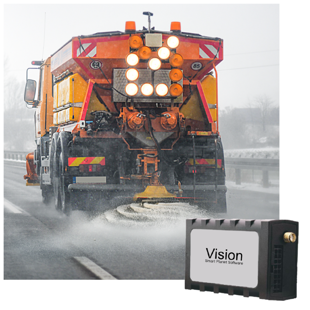
VISION
Know exact material spread rate and how much salt is being applied to all surfaces.
Make more-informed decisions to improve material usage costs, worker productivity and efficiency.
Reduce the number of calls and inquiries from the public during a snow event.
Better manage time sheets & overtime, shift changes with the route completion percentage and printable maps.
Use vehicle location data to protect drivers from false property damage claims.
Metrics & mapping displayed for these leading spreader units: Bosch Rexroth, Certified Power, Dickey-John, Force America.
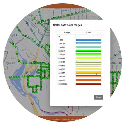
Salt, Sand, & Brine application tracking
Color-coded
application trail
Printable detailed
spreader reports
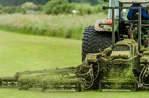
SMARTGPS
SmartGPS provides new capabilities for tracking and reporting on slow-moving assets that are not GIS location tagged. Whether it’s mowing the greenspace of parks and cemeteries, plowing parking lots or sidewalks, or even tracking and reporting on clean-up and reclamation efforts over water, SmartGPS by FleetPaths has you covered.